Monday, September 27, 2021

The New Testament City of Derbe

 Derbe - A city visited by Paul and Barnabas on their First Missionary Journey

https://graceofourlord.com/2012/10/15/acts-14-paul-and-barnabas-at-iconium-and-lystra/

Derbe (Greek: Δέρβη, Turkish: kerti höyük) was an ancient city in southern Galatia (also Lycaonia). It was the end destination of Paul and Barnabus' First Missionary Journey, dated between 44-45 AD

The Apostles spent an undetermined amount of time there, and when they left, they retraced their steps all the way back through Lystra, Iconium, and Pisidian Antioch and finally southward to the coastal city of Attalya, close to where they began the trip, on the Mediterranean coast. [Attalya is close to the initial "P" of "Pamphylia" on the map, above.] They then sailed back to Antioch of Syria. The entire journey was estimated to have taken approximately three years.

To me, one of the fascinating elements of this journey is the fact that the disciples were the first to take the Gospel to these geographical areas and people groups that had never heard of Christ - except perhaps through third person accounts (i.e. people sharing accounts from the "outside world" such as Ephesus or other cities on the Mediterranean coastline). Most native people had no previous interaction with representatives of this "new faith."

Judaism, on the other hand, had a much earlier presence in Asia-Minor, dating back into the pre-Christian era.

"The first synagogues in Asia Minor were apparently built at that time. Important evidence of the distribution of Jews in Asia Minor has been preserved in the Roman circular of 139 B.C.E. to the Hellenistic cities and states. It mentions Caria, Pamphylia, and Lycia as places of Jewish settlement (I Macc. 15:23). Cicero's account of the confiscation of the money which the Jews of Pergamum, Adramythion, Laodicea, and Apamea had designated for the Temple in Jerusalem, during the governorship of L. Valerius Flaccus, provides additional evidence of the spread of Jews in Asia Minor."

And, just in case you're interested in more specific information: 

"...by accounts of the Jewish communities in the New Testament – in Acts and in Paul's Epistles. According to these inscriptions, Jews were settled in the following regions of Asia Minor: Ionia, Mysia, Lydia, Caria, Lycia, Phrygia, Lycaonia, Cappadocia, Galatia, Bithynia, Paphlagonia, Pisidia, Cilicia, and other localities."  
Source: https://www.jewishvirtuallibrary.org/asia-minor

+++++

My picture below shows the current state of the city of Derbe!

Cliff_Emerson

This is what remains of the city - a tell, or large mound of earth and rock and a few tile fragments on the surface - rising above a flat agricultural plane. The mound's dimensions are roughly 450 x 250 meters (1476 x 820 feet).

Prior to the visit, I made a short stop at the Historical Museum in Karaman, 30 km. to the southwest, and looked for one of the important inscriptions on a stone in their collection that helped to positively identify the site of Derbe. [Scroll down to see this description.]

And before that, I drove by a similar mound of Lystra of Lycaonia near the village of Hatunsaray about 30 km. to the northwest. (Click here to see Acts 15:8-20)

Click here for my blog post about Lystra.

(I'm in the process of tracking down the reference for this graphic.)
+++++++++++

Derbe is mentioned four times in the Acts of the Apostles:

Acts 14:6, 14:20, 16:1 and 20:4

The Apostle Paul visited the city three times.

Interestingly, Derbe is one of two cities mentioned in the Acts of the Apostles where the message of the Gospel seems to have been positively accepted by most of its inhabitants. The other city is Beroea, located between Achaia and Macedonia, in Greece.)  In both, the Apostle Paul was apparently welcomed by their inhabitants without controversy or conflict.

#####

When driving out to the remote site of Derbe, you will travel on agricultural roads with few people and no traffic.

The Turkish farmers harvest sugar beets and load them onto these trailers - often 2-3 pulled in a train behind a tractor - to take them to gathering stations.
When driving by a farmstead, I saw a machine for chopping up sugar beet tops or alfalfa.
++++++

Paul and Barnabas came to Derbe after fleeing a disturbance at Lystra about 40 miles (65 km) to the west. There, Paul survived a stoning and was dragged out of the city. (Acts 14:8-20) Shortly thereafter, he was healed and returned to his mission of sharing the Gospel in neighboring cities.


Video: It was raining lightly when I drove out to Derbe. Notice the mound of the city increases in size on the right side of the road as I get closer.

I made my journey to Derbe in a rental car, and was fortunate to run into a fellow in a village who had just returned from England, and he gave me great verbal directions in English (rare in rural Turkey).


Below, you can see the only road sign on my entire journey. It would have been smarter for me to have found out the Turkish name for Derbe (Kertihöyük), and have writen it down on a piece of paper to show to the local people for directions.

cliff emerson

Derbe was connected to Laranda (Karaman) and Lystra by an existing Roman road.

http://imperium.ahlfeldt.se

The excellent map above (single-click to enlarge) shows the existence of Roman Roads that have been verified in Asia Minor and elsewhere in the Roman Empire. This particular screen shot shows the Roman cities of Derbe (green peg), Iconium, Lystra, Laranda (today: Karaman), and the Mediterranean Sea. Roman Roads are marked in red.

Compare that area with the region around "LYCAONIA" in the map below.


Brief Review: Tracing Paul's journey by using this map.

After coming in from the island of Cyprus by ship, Paul, Barbabus and John Mark landed at Perga. A disagreement with John Mark led to a splitting of the parties, and John Mark returned to Jerusalem on his own. Thereafter, Paul and Barnabas most likely hiked northward across the rugged Taurus Mountains to Pisidian Antioch (located at today's Yalvaç) and then eastward to Iconium (modern Konya - notice the similarity in pronunciation of the last city).

https://www.anatolianroads.org/roads/

This is what a Roman Road in Anatolia looks like today, not unlike its earlier appearance in the days of Paul. Pretty bumpy!

+++++

Next, at Lystra, on their third of four stops, Paul was stoned and left for dead. Immediately thereafter - on the following day - he and Barnabas decided to travel on to Derbe.

Paul's Future Trips through the Area:

Paul passed through Derbe on two subsequent journeys in a westerly direction through Asia Minor (Acts 16:1; Acts 20:4)

cliff_emerson
In case you want to drive to Derbe (Kerti Höyük), it is located 12 air miles (19 km) NE of Karaman. Good luck! I recommend taking a bus tour! I personally don't read or speak Turkish, and unless you're a seasoned and hearty traveler, don't go for the rental car option, especially by yourself. 

cliff_emerson
Potsherds (ceramic tile pieces - usually orange in color) scatted on the ground with small rocks.


Video above: Debris field on the hillside of Derbe
+++++

Even though explorers started to look for Derbe in 19th century, its location wasn't discovered until 1957 when researchers found a statue base with an inscription mentioning Derbe. 

Today, there are no significant settlements nearby - only cultivated and grazing land.

Pottery pieces and other small objects found at the site are displayed in the museums in Karaman and Konya. A good reference is Mark Wilson's book: Biblical Turkey.

On the flanks of the hill where the city remains, I found a shepherd and his flock.

cliff_emerson

You may certainly be disappointed in the site of Derbe because it offers basically nothing to see. Just be sure to climb the mound and look for artifacts as you go (do not keep them, however), inspect the archaeological excavations on the top, and get a panoramic view of the landscape in all directions. The day I visited, the weather was rather hazy.

cliff_emerson

The famous Roman geographer, Strabo, gives us clues about the location of Derbe in his Geographica book; volume XIII, page 569. The history of the site dates back to local kingdoms in Anatolia. Later - in 1st century BC, Romans came and took over the territory, so it became a part of Galatia.

After the original spread of Christianity, the city of Derbe was ruled for several centuries at first as part of the Roman Empie, which later became the Byzantine Empire. Arabs invaders invaded Asia Minor and destroyed the city in 7th century AD. Its inhabitants finally abandoned Derbe around the 10th century. After Seljuk Turks (also Muslims) settled in the region from 11th century on, a small village was founded in the area.

 Christianity, as we know it under the auspices of Byzantium, was basically annihilated - that is, wiped-out. Henceforth, believers had to either convert, live in dhimmitude, hide or flee. In this part of the world - throughout the neighboring area of Cappadocia - there are plenty of manifestations of this dilemma observed in the countryside - deep holes in the ground (multi-storied) where people were forced to live, or caves dug out of the hillsides or canyons, often perched high above the ground where they could not be attacked. [Look for such a post from me in the future that features these items.]

cliff_emerson

View of the top of the mound - archaeological excavations.

Derbe was an important center of Christianity in this geographical area during early Byzantine rule. They sent bishops to represent Derbe at the Ecumenic Councils of Ephesus in 413, Chalcedon (today's Kadiköy - located in the Asian district in Istanbul) in 451, and Constantinople in 692.

After facing difficulties in Lystra, Paul ...went on with Barnabas to Derbe. After they had proclaimed the good news to that city and had made many disciples, they returned to Lystra, then on to Iconium and Antioch” (Acts 14:20-21). 

Using the Barrington Atlas of the Greek and Roman World, Mark Wilson notes the great distances covered in this brief statement above: 

Travel from: 

    • Derbe to Lystra (via Laranda)     81 miles
    • Lystra to Iconium                        21 miles
    • Iconium to Pisidian Antioch        92 miles

  • Paul and Barnabas then turned back toward Perga over the rugged Taurus Mountains to return to the Anatolian coast, and sailed to Antioch of Syria. 

  • During the 2nd Missionary Journey in Acts 16, Paul returns to the area with Silas, where they meet the disciple Timothy.

https://www.biblicalarchaeology.org/daily/news/derbe-excavations-explore-pauline-site/

Incidentally, Gaius, a disciple, was converted and later joined Paul's team on the third journey that went through the region (see Acts 20:4).

An interested note: Paul and Barnabas journeyed back to Lystra and Iconium and strengthened the small flock of believers in each place before heading home. They didn't avoid these places even though they faced persecution there.

+++++

The site of Derbe remained undiscovered and unverified until the 20th century. It is one of the three non-excavated New Testament city sites buried under a tell (a large mound; Turkish:  höyük)  in  modern Turkey.  (The other two cities, Lystra  and  Colossae, are  located further to the west.) 

In 1956  M. Balance discovered  an inscription dated at 157 AD at the present site, Kerti  Höyük, northeast  of  Karaman  that  mentions the New Testament city of Derbe. It is located at the Konya Archeological Museum. 

In  1967 B. Van Eldersen discovered another inscription nearby that names a bishop of Derbe and confirms the biblical site's existence at the present mound in the 4-5th Century. It reads: "...the most God-loving Michael, bishop of Derbe." This rock with its inscription is now displayed at the Archeological Museum in Karaman (see it pictured below).


References: 

https://www.sevenchurches.org/asia-minor-archaeology/


Here's an online news source from back in 2013:

Derbe Excavations Explore Pauline Site - Bible and Archaeology News Hurriyet Daily News

Noah Wiener  September 06, 2013


The Derbe Excavations

Excavations near Karaman in southern Turkey have begun to uncover remains from ancient Derbe, a site of Paul’s evangelizing in Acts 14-16. According to Dr. Mark Wilson,* director of the Asia Minor Research Center in Antalya, Turkey, Derbe was one of the only known New Testament sites left unexcavated in Turkey, along with Colossae and Lystra. 


Karaman governor Murat Koca told Hurriyet Daily News that “We think the place where he [Paul] lived is this tumulus. Works are continuing to prove this fact. This excavation has much importance to Karaman, because if we can find a work from the early period of Christianity, this place will be an important center for faith tourism.”


https://ferrelljenkins.blog/2007/06/01/iconium-pisidian-antioch-attalia/

Derbe Excavations Explore Pauline Site

https://www.biblicalarchaeology.org/daily/news/derbe-excavations-explore-pauline-site/ 


Below is a picture of an interesting artifact and comment from a visitor to the Derbe site:

https://bramanswanderings.com/2014/05/14/tells-tell-a-tale/

I had many similar experiences during my journeys in Turkey - picking up objects: I would seriously like to collect such artifacts, but felt compelled to leave them on the site where I found them. You should be ethical and honest with such items -  archeologists need these artifacts to map and interpret the area. I also could not imagine the kind of hassles you would experience at the border or airport when leaving the country with them in your possession! It's illegal!

+++++


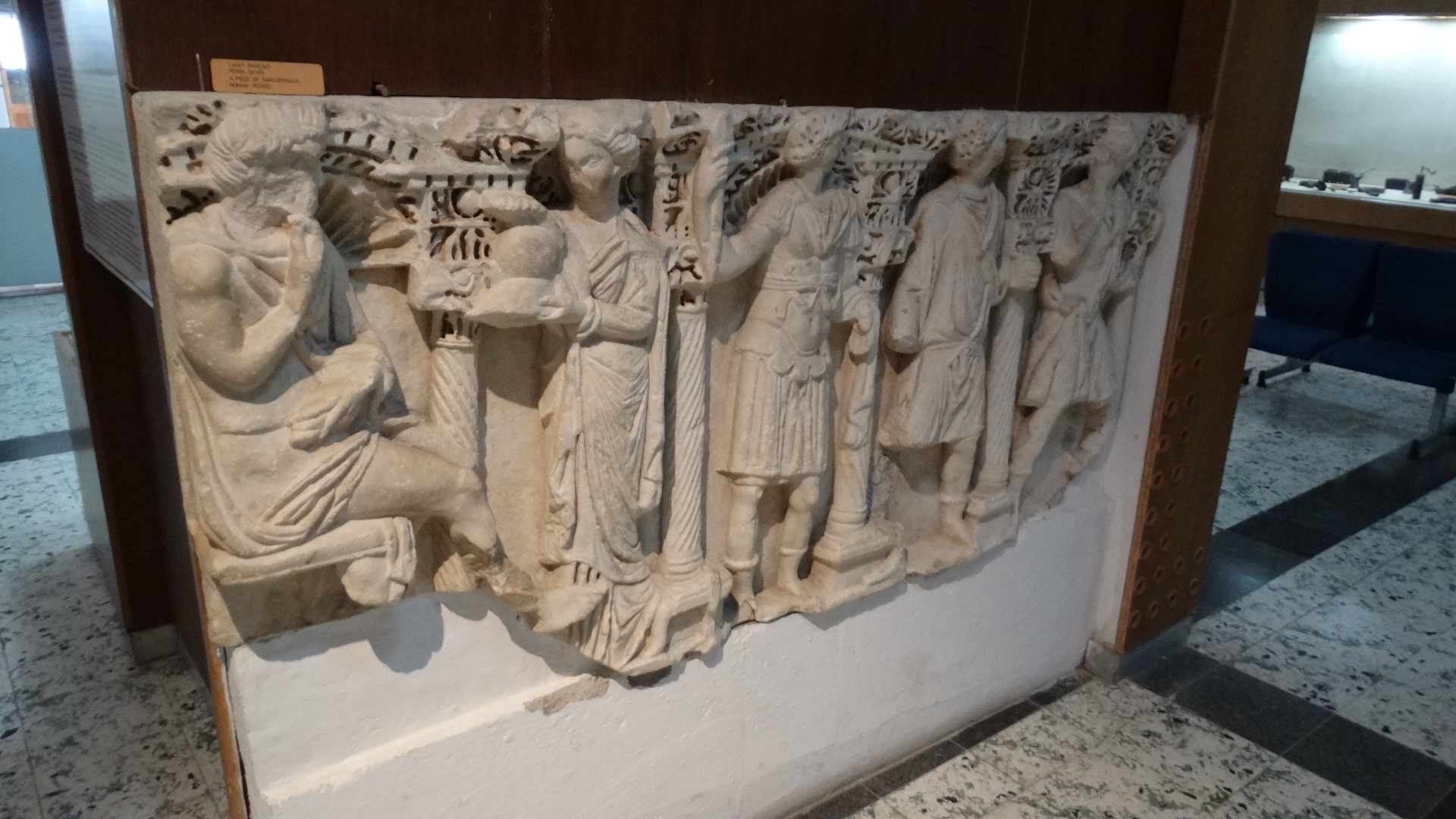
Following are some pictures from the fortress in Karaman and the Karaman Archaeological Museum:


City Fortress: (closed to the public. I'll have look for research on this structure.)


cliff_emerson

King Barbarossa and his troops came through this city on the way to the south in a Crusade.


Interesting artifacts observed during my visit to the Archaeological Museum in Karaman.

Sarkophage 


This is the stone that helped to establish the location of the site of Derbe being in its current location. The inscription mentioned Bishop Michael of Derbe.
This stone has some Christian markings that are hardly visible  - a large cross inside a circle on the right side where the crack is located.

In intriguing piece that portrays what may be Mary and the Christ Child in the top row, center panel.

A cute, dumpy saint holding a bunch of grapes.


Above, a video I made while leaving the area that afternoon, traveling further toward the east.

To see a continuation of this trip - to visit the Hittite Carvings at Ivriz post - click here.

To return to the Table of Contents, click here.

Saturday, April 17, 2021

Island of Rhodes: A visit to Lindos

 Acropolis of Lindos

After spending a day in Rhodes City, we took a bus about 34 miles (52 km.) down the east coast of the Mediterranean to the village of Lindos.
http://www.lovegreekislands.com/rhodes-map.html

This picturesque town is nestled in a small valley around the hillside of the attractive acropolis (high part of city) between two two bays on either side - north and south.
cliff_emerson©
Here are several views north of the Pallas Bay, interesting but not especially attractive to me. 
cliff_emerson©
Sailboats, a dock, beach chairs, sunbathing, rocks, warm water...
cliff_emerson©
...not exactly my idea of a fun summer holiday while visiting Greece (seriously).
cliff_emerson©

My summer vacations usually focus on historical sites and looking at or experiencing outstanding things of natural beauty.

https://ontheworldmap.com/greece/city/lindos/lindos-tourist-map.html
The bay on the south side is much more intriguing (right side of map, above) - the so-called "St. Paul's Bay." You can see it best by looking down from the acropolis.

cliff_emerson©
"What a cool place - it needs to be investigated!"

https://greekreporter.com/2019/08/03/the-ten-best-beaches-on-rhodes-the-island-of-knights/

This bay looks inviting - like a solitary lake or sinkhole... so, let's explore.

Below is a comprehensive, but short (2 minute) YouTube video about St. Paul's Bay shot from a drone.

+++++

Here's what the World Beech Guide says about St Paul’s Bay:

>>Despite its diminutive size, Saint Paul’s Bay is one of the most popular beaches on the Greek island of Rhodes. Located on the edge of the historic village of Lindos, St Paul’s Bay is enclosed by rocks with a small outlet for boats. 

This spectacular setting is further enhanced by a small Greek Orthodox chapel in the cove which harmonizes with the ruins high above of the ancient Acropolis of Lindos.

cliff_emerson©

Saint Paul’s Bay has two lovely stretches of sand. The clear blue water here gets quite warm, and the air temperature can reach 40°C (104°F) in the summer. With such secure surroundings and a narrow opening to the sea, this bay is well-suited for swimming and snorkeling; for snorkelers, there are also plenty of fish to be spotted amongst the rocks.<<

My wife and I came down to the beach behind the location of the mast of the sailboat you can see in the picture below, and swam around the rocks out to the sea. It was fun to get beat-up by the waves and explore a some shallow caves.

>>Surrounding the cove are a few tavernas where you can grab a bite to eat, and the village of Lindos is a 10 minute walk away. The chapel down in the cove St Paul’s Bay is a popular spot for weddings for locals and tourists.

Up in Lindos, the picture-postcard beautiful streets are lined with cobblestones and whitewashed houses and an occasional donkey for packing tourists.<<

https://www.worldbeachguide.com/greece/city-beach-west.htm

Here's the critical reason why this bay is so interesting from an historical perspective: 

Many historians think that the Apostle Paul stopped at this bay on his Third Missionary Journey traveling back to Jerusalem.


It is documented that Paul and his companions stopped somewhere on Rhodes on that homeward stretch - while coming down from the far north of the Aegean Sea at Macedonia, passing along the western coast of (today's) Turkey, and heading east toward Antioch of Syria.


Unfortunately, the Luke narration in Acts provides no specific historical record of interactions with people on the island of Rhodes. 


Here's is Luke's description in Acts:

>>When we had parted from them [the Ephesian elders at Miletus] and set sail, we ran a straight course to Cos and the next day to Rhodes and from there to Patara; and having found a ship crossing over to Phoenicia, we went aboard and set sail.
<< Acts 21:1-2


Paul's 3rd Missionary Journey: Starts at Antioch, and finishes at Tyre.


This passage presents an important concept of travel across the Mediterranean in those days: 


>>"...and having found a ship crossing over to Phoenicia, we went aboard and set sail." << Acts 21:2


When traveling by ship in the Mediterranean, one had to make arrangements with commercial ships bound for chosen, specific ports - either days or hours in advance or immediately when arriving at the port on another ship - and finding a connecting ship.


In the above passage,


"...and having found a ship crossing over to Phoenicia, we went aboard and set sail."


it appears that Paul and his companions found a ship with just the right destination.


NOTE: There were no passenger ships (aside from troop carriers or warships) in those days, so the ship's owner or captain usually pre-determined the destination of the ships.


If you were lucky, you might be able to catch a ship in the bay that was going your direction. If not, you might have to settle for a ship going in another direction, and then try to make connections to your original destination.


As one would expect, the traveler had to pay the fare after negotiating a price. Travelers would be responsible for your own food and water and bedding. This was not an easy way to travel. (I know I'd have a hard time sleeping, not to mention being out in the sun all day without suntan lotion!)


Continuing with Professor Ferrall's travel description in his web site:

>>Our ship (Dr. Ferrall's) docked at the harbor of the city of Rhodes, capital of the island of Rhodes. Here, in ancient days, stood the colossus of Rhodes — one of the seven wonders of the ancient world. The statue fell during an earthquake in 226 B.C., but its remains were seen as late as the 7th century A.D. (LINK in this blog).


Assuming that Paul’s ship docked here, he would have seen ruins of the famous monument. (That's an interesting thought.) Considering the course of travel mentioned in the text (Cos to Rhodes, and then Patara) it appears more likely they may have stopped at Rhodes City.


One tradition states that Paul’s contact with the island was at Lindos, one of the three ancient cities of the island and one with an excellent harbor. The small Greek Orthodox chapel in the village commemorates the landing and preaching of the apostle. In the book, A Guide to Biblical Sites in Greece and Turkey (Fant and Reddish), it is believed that “The harbor was once home to the Greek fleet of Lindos and the only natural harbor on the island of Rhodes”.<<


Let's take a walk through the village, and go to our hotel.

Trip_Advisor


cliff_emerson©
Here I am "schlepping" our suitcases down to the hotel from the bus stop. Remember, our rental car was back in the ferry parking lot at Marmaris, Turkey.
cliff_emerson©

Hotel Xenones Lindos

Time for a dinner date with my wife at the hotel.
cliff_emerson©


cliff_emerson©
It looks healthy.
cliff_emerson©
Looking past the edge of the acropolis out to sea.

cliff_emerson©
Photo above: Just past sunset from the north side of Lindos village over the north bay. The large mountains are probably located back in Turkey - I don't think we passed thorough  such high mountains while traveling from northern Rhodes.

https://www.google.com/maps/place/Ancient+Theatre+of+Lindos/@36.0906994,28.0852628,1463m/data=!3m1!1e3!4m13!1m7!3m6!1s0x14950e733690c711:0x49124bad9c3add47!2sPaulusbucht!3b1!8m2!3d36.0871048!4d28.088309!3m4!1s0x14950e74916bf951:0xe28ecfe3e68922bf!8m2!3d36.0897928!4d28.0871141
Lindos village: our hotel was on the western side of the old section of the village.
cliff_emerson©

A group of local people dressed in ancient Greek costume made their way up the acropolis. Perhaps they were going to perform at a classical theater.

Now it's time to start the walk up to the acropolis.
cliff_emerson©
While starting up the path from Lindos to the acropolis, we ran across a curious rock carving in a side wall. 
cliff_emerson©
It was a carving of an ancient Greek warship. More specifically, it was a relief of a Rhodian trireme (warship) cut into the rock at the foot of the steps leading to the Lindos acropolis. It is the work of the sculptor Pythokritos, and the relief dates from about 180 BC.

Specific information:
"It portrays the stern of a warship (triemiolia) in relief from the early 2nd century B.C.

Part of the relief served as the base of a bronze portrait statue of Hagesandros son of Mikion, whom the Lindians honoured on the occasion of a Rhodian naval victory.

The stern of the warship (triemolia) preserves traces of red pigment and is rendered in detail, with the aphlaston DEFINITION at the right end and the richly bedecked captain's seat in the form of bird's wing.

https://s3.amazonaws.com/gs-waymarking-images/1e215700-7300-4d0a-b430-2578bf1900c6.jpg


Identifiable on the back of the base - within a small temple (naiskos) - is a standing female figure with kalathos on the head. Preserved on the rock in front of the relief is a row of holes, in which were set the iron railings that protected the monument.
https://commons.wikimedia.org/wiki/File:Lindos_Rhodian_trireme_relief.jpg

According to the inscription on the hull of the ship, the work was created by the renowned Rhodian sculptor Pythokritos son of Timocharis.

The Rhodian's preoccupation with representations of ships in art was closely linked with their maritime tradition and  superiority in producing fighting ships.

"Relief stern of a warship (triemiolia), early 2nd c. B.C. -
The relief served as the base of a bronze portrait statue of Hagesandros son of Mikion, whom the Lindians honoured on the occasion of a naval victory of the Rhodians."
https://www.waymarking.com/waymarks/wm11FV9_Relief_of_a_Rhodian_Trireme_Lindos_Greece

+++++

While in Rhodes City earlier, we ran across this memorial.
cliff_emerson©

We found it discouraging that Jews were rounded up in this far-distant, remote part of the world. Below is an article about the deportation of Greek Jews, specifically from a site in Thessaloniki - further along the transportation route north to the concentration camps in Poland:

Greek Jews remember transport to Nazi death camps
https://federalnewsnetwork.com/national-world-headlines/2015/03/greek-jews-remember-transport-to-nazi-death-camps/

By The Associated Press
March 15, 2015
By COSTAS KANTOURIS

THESSALONIKI, Greece (AP) — Residents of Greece’s second-largest city on Sunday placed flowers on train tracks and inside old cattle wagons in solemn remembrance of nearly 50,000 local Jews who were transported to Nazi death camps during World War II.

About 2,000 people joined together at Thessaloniki’s Freedom Square for the 72nd anniversary of the roundup and deportation of the Jews. Some held banners that said: “Racism Kills, Let’s Learn from History,” and “Never Again.”

The crowd then marched to the northern city’s old railway station, where the first of 19 trains departed for the Auschwitz-Birkenau concentration camp complex on March 15, 1943.

A locomotive believed to have been used to transport Jews, and four carriages that normally would carry cattle and in which people spent nine days locked up on their way to the extermination camps, were at the station. The crowd laid flowers on the wagons and the tracks.
https://encyclopedia.ushmm.org/content/en/article/german-railways-and-the-holocaust?parent=en%2F5041

“It was a horrible, mournful, rainy day. Even the skies were weeping,” recalled Heinz Cunho, 87, one of fewer than 100 surviving Greek Jews who made it back from the camps. “Normally, the carriages held 50 people. There were 80 of us to a wagon, and they had us locked up throughout the nine-day trip.”

Greece’s government has recently decided to make demands for German World War II reparations worth the equivalent of 50 million euros ($53 million), paid as a ransom to Nazi occupiers in 1942 to free about 10,000 Jewish men used as slave laborers in Greece. They were freed, but still sent subsequently to death camps.

Jews, mostly Sephardic refugees from Spain and the Inquisition (starting in 1492), formed the majority of Thessaloniki’s inhabitants from the 16th to the early 20th century. Their numbers dwindled in the early 20th century.


cliff_emerson@
cliff_emerson@


A locomotive believed to have been used to transport Jews, and four carriages that normally would carry cattle and in which people spent nine days locked up on their way to the extermination camps, were at the station. The crowd laid flowers on the wagons and the tracks.


cliff_emerson@

Of the 46,091 Thessaloniki Jews sent to the camps, 1,950 survived. Others avoided the camps by either joining the partisan resistance or escaping to Turkey by boat, with the help of residents, and eventually making it to the Middle East. The original Jewish community of Thessaloniki numbered nearly 800,000, but today is fewer than 2,000.

“We are marching upon the footsteps that Greek Jews marched back then. We must remain united and opposed to Nazism, racism and anti-Semitism,” said David Saltiel, head of Thessaloniki’s Jewish community.
https://encyclopedia.ushmm.org/content/en/article/german-railways-and-the-holocaust?parent=en%2F5041
Several years ago, my wife and I made a trip from Vienna, Austria to Auschwitz/Birkenau, Poland following the train route that brought Jews in the Holocaust from Greece and the Balkan countries - a moving experience. You can easily see this route on the map.
More information: LINK
++++++
Back to Lindos: Worth mentioning: there is a small partially-destroyed ancient theater to visit below the acropolis.
https://www.google.com/maps/place/Ancient+Theatre+of+Lindos/@36.0897928,28.0871141,3a,75y,90t/data=!3m8!1e2!3m6!1sAF1QipMsr9y1AsxEyHFhiJjrzgrnvJWnCA-NDLTaif-b!2e10!3e12!6shttps:%2F%2Flh5.googleusercontent.com%2Fp%2FAF1QipMsr9y1AsxEyHFhiJjrzgrnvJWnCA-NDLTaif-b%3Dw203-h152-k-no!7i3648!8i2736!4m13!1m7!3m6!1s0x14950e733690c711:0x49124bad9c3add47!2sPaulusbucht!3b1!8m2!3d36.0871048!4d28.088309!3m4!1s0x14950e74916bf951:0xe28ecfe3e68922bf!8m2!3d36.0897928!4d28.0871141

https://www.google.com/maps/place/Ancient+Theatre+of+Lindos/@36.0897928,28.0871141,3a,75y,90t/data=!3m8!1e2!3m6!1sAF1QipMsr9y1AsxEyHFhiJjrzgrnvJWnCA-NDLTaif-b!2e10!3e12!6shttps:%2F%2Flh5.googleusercontent.com%2Fp%2FAF1QipMsr9y1AsxEyHFhiJjrzgrnvJWnCA-NDLTaif-b%3Dw203-h152-k-no!7i3648!8i2736!4m13!1m7!3m6!1s0x14950e733690c711:0x49124bad9c3add47!2sPaulusbucht!3b1!8m2!3d36.0871048!4d28.088309!3m4!1s0x14950e74916bf951:0xe28ecfe3e68922bf!8m2!3d36.0897928!4d28.0871141

In closing, let's turn our attention to a visit at the terrific Byzantine / Greek Orthodox church - Church of our lady Panagia in Lindos. 

TripAdvisor

THE CHURCH OF OUR LADY (PANAGIA), LINDOS

Just off the main square in Lindos is this cross-shaped 14th century church with an octagonal dome and whitewashed walls. 

Surrounded by high walls and a small courtyard, this old church was originally built in 1300 and has since gone through numerous reconstructions. The most important renovation was ordered by the Grand Master Pierre d’Aubusson (1476 to 1503) of the Knights of Rhodes (Order of St. John in Rhodes City) and the most recent is dated in 1927, during the Italian occupation.

https://ecotourism-greece.com/attractions/the-church-of-our-lady-panagia-lindos/

The Chapel of St Paul is located a short distance from St. Paul’s Bay. It is said to be the first place Saint Paul visited during his stop-over on Rhodes. Today, it is a popular wedding venue for foreigners.

The church of Panagia (Our Lady) is full of enchanting images and is certainly an obligatory stop for all visitors at Lindos.

Its dark interior, with a black and white pebbled floor, is decorated with eighteenth-century frescoes of male saints on the right and female on the left.

In the interior the pavement is covered by a superbly executed pebble mosaic (hohlaki), popular in the Rhodian traditional architecture. In the front, there is a richly decorated and spectacularly carved wooden iconostasis and a Bishop’s throne with a large bronze layered candle chandelier hanging from above. 

Visitors will be astounded by the quality of the 19th century wall frescoes, depicting biblical scenes. 
cliff_emerson©
>>The barrel-vaulted roof and the dome there covered with more impressive the work of the famous Gregorios of Symi dating back in 1779, depicting icons of Mary, Jesus, and the saints.

As the viewers turn to the back of the church and walk out, over the doorway, a huge colorful fresco bursts with the story of The Last Judgment. Pale twisting bodies writhe together in the orange and red flames of hell. A strong message for those who won’t follow the ways of the church.<<
cliff_emerson©
A device of the Grand Master D’Aubusson can be seen on the western door of the church as well as an inscription bearing the dates 1489/90, dates of the additions made to the building.

Panagia: one of the Greek Orthodox names used to address the Mother of God. In Orthodox art, the term Panaghia denotes an icon depicting the Virgin Mary with the Christ Child.

Iconostasis: a wall usually made of wood or marble, full of icons and religious paintings, separating the nave from the sanctuary in a church.

https://discover-rhodes.com/explore/attractions/church-of-panagia-in-lindos/

cliff_emerson©

Click on the following link to access more information about Lindos:

ANCIENT LINDOS AND ACROPOLIS: LINK

The End.

+++++

Before closing, here's an fascinating article about an entirely different Greek topic that I just ran across on-line (April, 2021): The discovery of a ancient computer-like device called the Antikythera Machine.

The Antikythera Machine:

https://www.britannica.com/topic/Antikythera-mechanism
It was found in the ocean off a Greek island and is believed to have been designed over 2000 years ago by the ancient Greeks  - the Antikythera Device.


https://www.youtube.com/watch?v=UpLcnAIpVRA

Click here for a separate window with additional information about the Antikythera machine.

Click here to return to the Table of Contents.

Featured Post

Hittites in Turkey #2 - Yazilikaya

Yazilikaya - Holy sanctuary at  the Hittite capital of Hattuša Yazilikaya (m eaning 'inscribed rock' in Turkish), is an  ancient Hit...